Where did Sole Bay go?
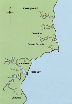
This is an estimated outline of how the coastline from Kessingland to Dunwich looked in the 11th century. Sole Bay really was a bay, set between the twin promontories of Easton Bavents and Dunwich. The profile indicates a prevailing northerly wind. Southwold is shown here as an island but this is only conjecture.
When you drag your mouse over the map you see the same coast as it is today - smoothed by what has become a prevailing south-westerly wind resulting in a high erosion rate. In the 1990s, Covehithe lost 17 metres of coastline in one year.